Click below to download a paper presented at the 2016 Annual Alberta Expropriation Conference titled:
"Showing Your Case: New Opportunities for Demonstrative Evidence", by Keith Wilson, B.A., LL.B.
Click below to download a paper presented at the 2016 Annual Alberta Expropriation Conference titled:
"Showing Your Case: New Opportunities for Demonstrative Evidence", by Keith Wilson, B.A., LL.B.
Click below to download a paper presented at the 2016 Annual Alberta Expropriation Conference titled:
"Showing Your Case: New Opportunities for Demonstrative Evidence", by Keith Wilson, B.A., LL.B.
Click below to download a paper presented at the 2016 Annual Alberta Expropriation Conference titled:
"Showing Your Case: New Opportunities for Demonstrative Evidence", by Keith Wilson, B.A., LL.B.


DRONE VIDEO
EVIDENCE
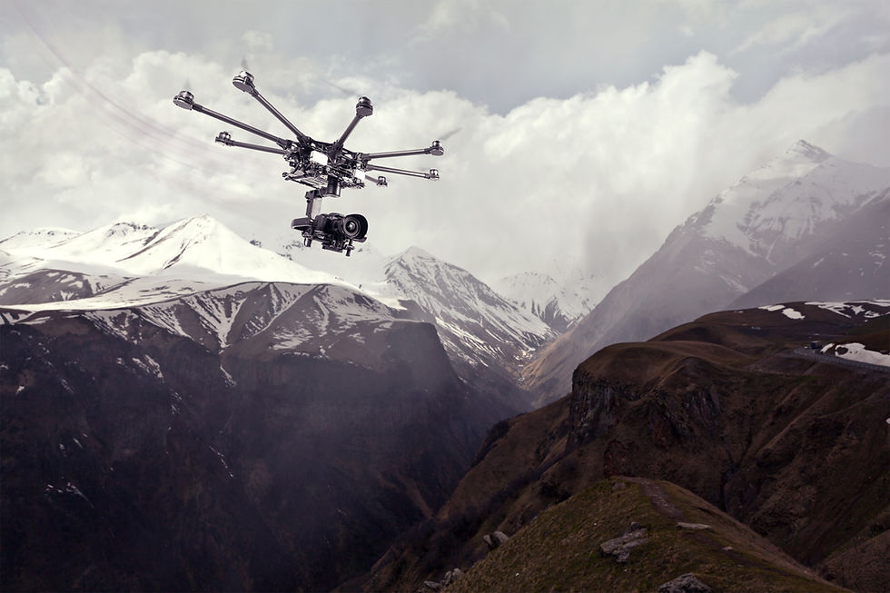
Where the issue involves land, the environment, physical structures or places, use of drone video evidence can enable lawyers, experts, and investigators to provide the judge, tribunal members, and decision makers a first-person tour of the subject.
ACCEPTED.
TESTED BEFORE THE COURTS & REGULATORS.
Veritas evidence aids have been accepted in proceedings before the Alberta Utilities Commission, Municipal Government Board, the Alberta Environmental Appeals Board, the Alberta Energy Regulator, the Surface Rights Board, the Land Compensation Board, municipal development appeal boards, the Alberta Court of Appeal and others.
AERIAL EVIDENCE
AND ITS EFFECTIVENESS
(CLICK FOR VIDEO)

COST AWARDS APPROVED
AUC Decision 22406-D01-2017, June 9, 2017, cost ruling:

56. The Commission finds that the [Veritas] drone video evidence was pertinent to the [landowners’] issues and depicted the proposed transmission line in relation to his property, house, wetlands on and nearby his property in a medium and perspective that assisted the panel in understanding exactly why he was concerned with the location of the transmission line. The Commission finds that in this case, it was more effective to view the aerial video than follow a witness’ verbal, written, still photographic or mapping evidence of distances, location and size of impacted land features.
USES OF
DRONE VIDEO EVIDENCE
AUTOMOBILE
ACCIDENTS
OH&S INCIDENTS
LAND DEVELOPMENT HEARINGS & APPROVALS
WATER LAW, WETLANDS & DRAINAGE DISPUTES
ENVIRONMENTAL CONTAMINATION & REMEDIATION
CONSTRUCTION DISPUTES
CONSTRUCTION DISPUTES
ENGINEERING FAILURES
INSURANCE CLAIMS
TRAIN DERAILMENTS
ARSON INVESTIGATION
ROW ANALYSIS & UTILITY HEARINGS
POST-INCIDENT
INVESTIGATIONS
REGULATORY
APPROVALS &
PERMITTING
PHOTOGRAPHIC EVIDENCE
PRESERVATION
EXPROPRIATION
EXPROPRIATION
INDUSTRIAL INFRASTRUCTURE INCIDENTS
AVIATION
INCIDENTS
AGRICULTURAL
CLAIMS
TAX ASSESSMENT
APPEALS
SUBDIVSION
APPROVALS
DRONE VIDEO EVIDENCE
POST-PRODUCTION TECHNIQUES
Our focus for our post-production services is to show the areas and subject matter involved in the case authentically and accurately while also providing annotations that clearly and clinically define the subjects of interest in your case.

BASIC:
STILL ANNOTATION & HIGHLIGHTS
Veritas Litigation Support has developed a variety of animations techniques for all budgets.

ADVANCED:
ANIMATED MOTION GRAPHICS
This post-production technique involves utilizing advanced animated motion graphics within our drone video to create clear labels and annotations that are tracked to follow the motion of the subject within the drone video. During the evidence video production process, Veritas Litigation Support consults with the lawyer's, experts, and investigations to ensure that the animated motion graphics inserted into the drone evidence video are authentic and clearly define the subject matter.
Veritas Litigation Support uses a series a wide range of modern post production techniques to highlight, outline and identify
Veritas Litigation Support uses a series a wide range of modern post production techniques to highlight, outline and identify


ANIMATED AERIAL MAP
Our animated aerial maps make use of satellite imagery to create a detailed map that shows the subject lands at a significantly higher altitude than what is possible with a drone. These elevated views allow us to put the subject lands to be viewed in a broader context and surrounding area. Combining the animated aerial maps with our drone footage creates a powerful and informative evidence tool that clearly demonstrates the details and landscape of the subject land via our ultra HD drone footage as well as revealing the larger area around the subject, putting the subject lands in context.

SAFE.
INSURED.
COMPLIANT.
EXPERIENCED.

CERTIFIED

REGISTERED
Veritas drone evidence is obtained by our drone services group, SmartDrones, which holds an extraordinary Special Flight Operations Certificate (Restricted Complex) issued by Transport Canada under the Canadian Aviation Regulations that authorizes SmartDrones to fly locations throughout western Canada without going through a separate, time-consuming application process for each project. We are fully insured and are registered with Nav Canada. Our pilots are trained, certified and have many years of accident-free flying.
The regulations for commercial drone use are rapidly evolving. One of the additional unique services that is included in our services is ensuring regulatory compliance. We are the only drone services company in Canada that has an experienced regulatory lawyer on staff that looks after obtaining the required permits from Transport Canada, Nav Canada and any provincial or national parks licenses. We know the rules and have a good working relationship with the regulatory officials.
We are also current with applicable legal provisions relating to flying over private lands, privacy and municipal bylaws.